
Our Work
Topic: Data Analysis
Displaying 1 - 10 of 39Project

topics: Data Analysis, Urban Flooding, Water
Chicago Urban Flood Detection Pilot In August 2025, Center for Neighborhood Technology in partnership with Verizon and Hyfi launched an urban flood detection pilot to better understand how flooding impacts neighborhoods across the city. The pilot includes 50 sensors built by Hyfi and deployed...
Project

topics: Data Analysis, Policy
We’re creating a trust-based collaborative model to collect, analyze, protect and share data generated from and providing insights into our communities
Tool
topics: Data Analysis, Environmental Justice, Policy, Water
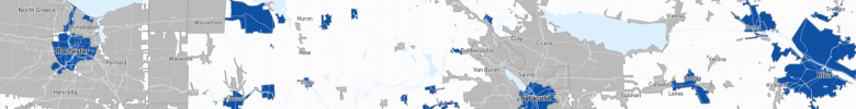
The DAC Mapping Tool highlights state-defined disadvantaged communities (DACs) under the Drinking Water State Revolving Fund (DWSRF) program in six Great Lakes states. It helps users understand how states define DACs and who benefits from DWSRF funding.
Story

topics: Climate, Data Analysis, Environmental Justice, Policy
en español Communities like McKinley Park miss out on federal Justice40 benefits by a narrow margin. It doesn’t have to be that way. The Climate and Economic Justice Screening Tool (CEJST) aims to identify “disadvantaged census tracts” for prioritizing federal funding and informing the national...
Story
topics: Data Analysis, Housing, Transportation
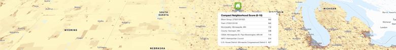
Continuing our series digging into the H+T Index, today we highlight what we learned about who uses our most popular tool from a recent user survey. We received 117 survey responses. While that represents just a fraction of the H+T Index’s regular monthly user base — the tool is accessed more than...
Tool

topics: Climate, Data Analysis, Environmental Justice
CNT and the Little Village Environmental Justice Organization counted trucks and buses throughout Chicagoland. The counts available through this open-source portal shine a light on the problem of high truck traffic in environmental justice communities.
Story
topics: Climate, Data Analysis, Housing, Policy, Transportation
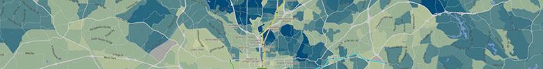
The main purpose of the H+T Index is to help users identify the most “location efficient” places across the United States by calculating the cost of housing as well as the cost of transportation to provide a more comprehensive understanding of the affordability of place. We learned through surveys...
Tool
topics: Data Analysis, Environmental Justice, Policy
Is the Justice40 Screening Tool identifying the most disadvantaged communities?
Project


topics: Data Analysis, Environmental Justice, Policy
The White House Justice40 Initiative aims to send 40% of dollars in federal infrastructure and environment programs to under-invested communities. But how do they measure that? We partner with frontline groups to monitor how well public investments line up with Justice40 goals.
Story
topics: Data Analysis, Equitable Transit Oriented Development, Housing, Policy, Transportation
The H+T® Affordability Index highlights location efficiency by using an “apples to apples” comparison of housing costs. What’s the Question? Users often ask why we use the median-income household in every block group in a metro area, pointing out that this misrepresents the actual costs for the...