
As data analysts and policy professionals, we spend a lot of time at our desks and behind screens, analyzing quantitative data, active or proposed policies and programs, and various written reports and documents. Much of what we analyze and review is -- or becomes -- an aggregation and anonymization of specific places, experience, and impacts, and fails to directly capture the intricacies of an individual’s lived experience. In our work with community-based partners, we’ve committed ourselves to spending time doing both the desktop research and getting to know our partners and their expertise through site visits and conversations, to craft a richer picture of community assets, impacts, priorities, and needs.
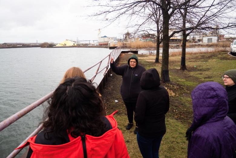
In early April, CNT staff took a trip down to Hegewisch to meet with our partner, Southeast Environmental Taskforce (SETF, helmed by Olga Bautista) and tour the Southeast Side of Chicago – one of the most unique landscapes in the city. Since 2020, SETF and CNT have worked together to identify gaps in understanding factors that impact local residential (from industrial corridor modernization best practices to local climate change issues) and analyze and visualize data to inform advocacy campaigns. We’ll be sharing our archival review and climate change impacts analysis in the coming months. This tour was, in part, a way to stretch our legs and visit a partner site after so many months of virtual meetings! It was also helpful in informing how SETF and CNT will structure our climate change impact analysis. Oftentimes quantitative analysis doesn’t tell the full story of climate change or other impacts, so engaging local experts to frame the analysis using oral histories and storytelling is a way to create a more complete picture and appropriately address needs.
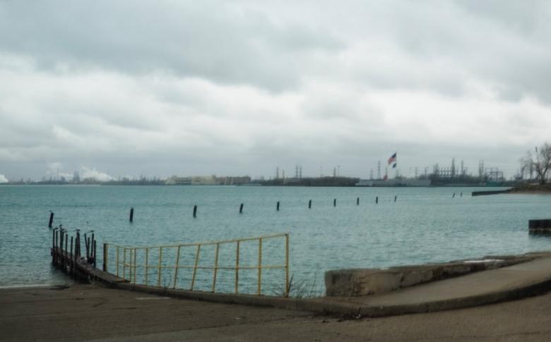
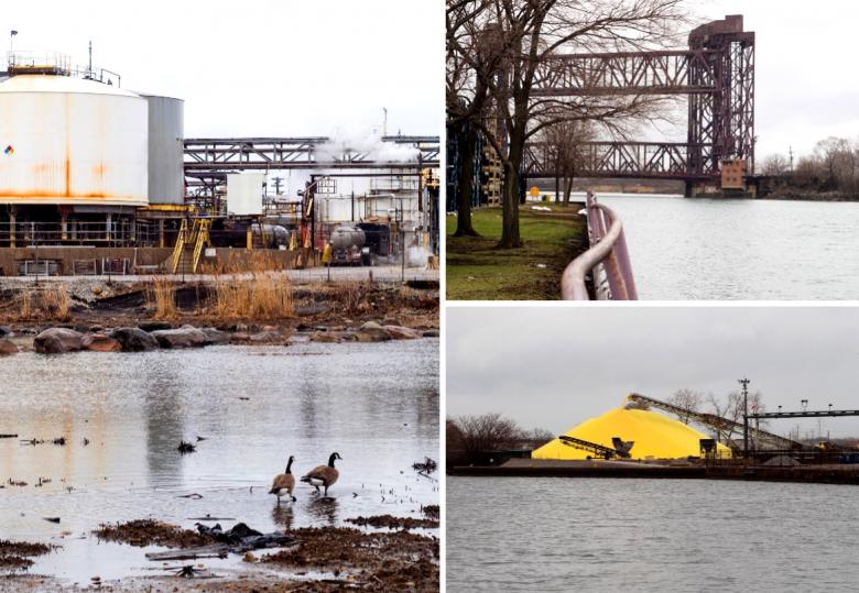
The Southeast Side of Chicago is rich in natural resources. The Calumet River snakes through Hegewisch, South Deering, and East Side before entering Lake Michigan. To the east of the Calumet River sits Calumet Park, a nearly 2,000-acre park with lakeside views and recreational facilities. To the west sits Big Marsh Park, a relatively new park with bike trails and a diverse habitat choice for bird watching. We drove to Calumet Park and looked out from the harbor at the BP Refinery in Whiting, IN.
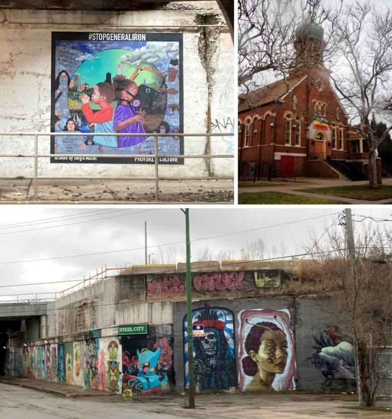
The Southeast Side is also full of present-day industrial users, and the scars of historical industrial activity. The Calumet Industrial Corridor is the largest industrial corridor by land area in the City of Chicago, and much of it is a Planned Manufacturing District. There are nearly 100 industrial users currently operating throughout the Southeast side, some of which (over a third, according to the Calumet Databook research) have active permit violations. Over the course of our drive through the neighborhoods, we visited a pellet factory, drove past the expanded Ford Motor Company lot, and passed by several railyards. Even some local parks host the skeletons of former industry – Steelworkers Park features the walls of a former steel mill.
And of course, the most important land user in the Southeast Side -- its residents. Significant tracts of land in the Hegewisch, South Deering, and East Side community areas are zoned residential and sit adjacent to large industrial users. Generations of families live in the community and both benefit from the assets of the area and are impacted, in big and small ways, by their industrial neighbors. In driving through, we not only experienced the difficulty of traveling through a neighborhood designed for industrial facilities but not the people who work there, but also stood witness to the many ways that residents have committed time and energy in building a meaningful life despite the industrial context. Olga, our resident tour guide and an expert oral historian, explained that many families live on the same streets and have worked in the area for decades – making it difficult to fathom moving away, despite the frustrations of witnessing land use decisions occur without meaningful community collaboration and the challenges of living with industry at their backdoor.
The interplay between industrial, open space, and residential land users is complex. Local community-based organizations (CBOs), like SETF, and broader coalitions of CBOS through the Chicago Environmental Justice Network (CEJN), and research coalitions like the one behind the in-depth Calumet Databook are actively exploring questions of open space access, economic development and diversification, cumulative impacts, industrial modernization, among others.
As we learned during our tour with Olga, and the analysis we’ve undertaken in partnership with SETF over the past few years, qualitative analysis is often THE missing piece when it comes to incorporating lived experiences in research methods. CNT and SETF will be working together in the coming months to expand our understanding of local climate change impacts, community sensitivities, and needs.