In collaboration with Front and Centered, a coalition working at the intersection of equity, environmental, and climate justice across Washington State, CNT’s Urban Analytics team developed the Washington Transit Access Map (WA TAM) to examine differing levels of transit availability and transit quality for residents across the state. For example, WA TAM reveals that Washington residents experience drastic inequalities in reliable transit service: nearly 70 percent of Seattle residents can count on a bus or train that comes every 15 minutes, while in Vancouver just 19 percent can, and in Tacoma and Spokane that number drops to 3 and 4 percent, respectively. The tool, in conjunction with Front and Centered’s new Transportation Justice Agenda for Washington State, is intended to influence legislation toward just transportation policies and investments.
-
Who We Are

-
What We Do

“CNT was able to help us reach new community organizations and do our work better.”
~ Erin Aleman, Chicago Metropolitan Agency for Planning
-
Our Work
Project Spotlight
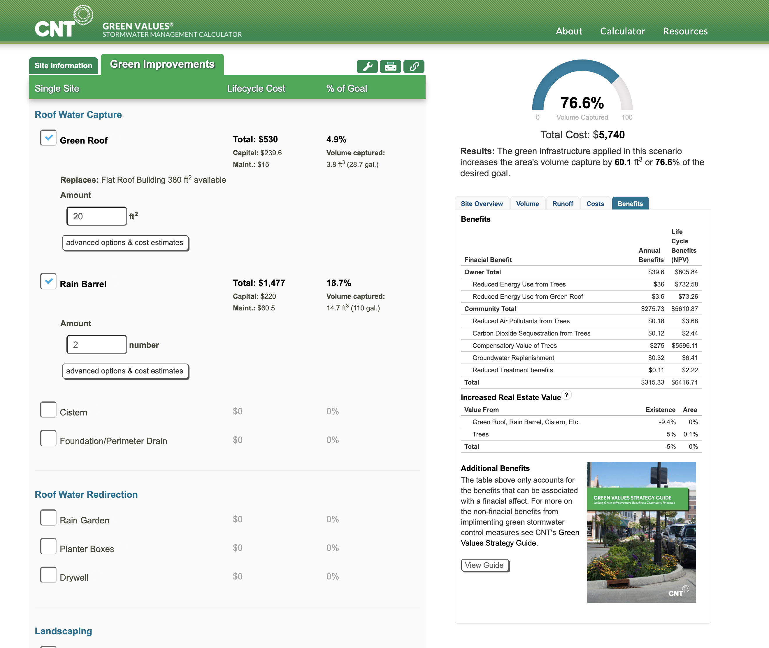
Green Values Calculator
The Green Values Calculator compares the performance, costs, and benefits of Green Infrastructure to conventional stormwater practices. -
Publications
- Stories